Google sharpens Maps, Earth with petabyte of crisp NASA satellite imagery

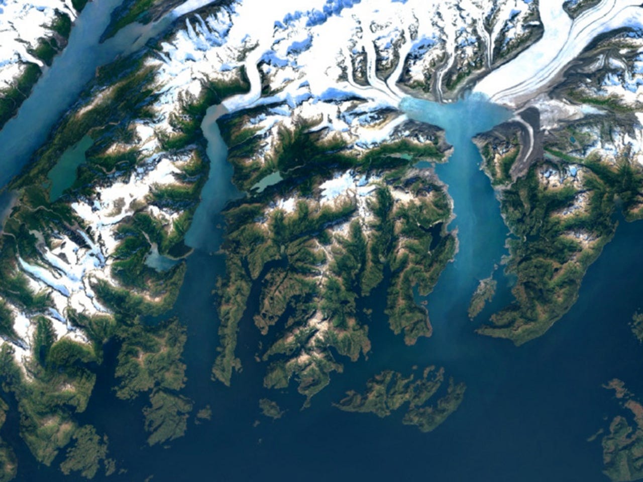
The 700 trillion pixels that Google has mined from NASA's satellite imagery include this view of the Columbia Glacier, Alaska.
Google's one billion Maps users should start to see sharper and more detailed images of Earth after the search company sifted through nearly a petabyte of NASA's latest satellite imagery to find the best cloud-free pixels.
All in all, Google mined 700 trillion pixels from NASA's satellite imagery to stitch together its latest mosaic of the world. These are now viewable through the newly-updated Google Maps and Google Earth apps, the company has announced.
The new, sharper images come from the Landsat 8 satellite, which NASA launched in 2013. This is this newest satellite in the United States Geological Survey (USGS) and NASA Landsat Program.
It's also more powerful than Landsat 7, which began operating in 1999 and provided the data for Google's previous update in 2013. That update was the first time Google was able to deliver a cloud-free view of earth.
Landsat 8 also captures images with more detail, richer colour and higher resolution than its predecessor, allowing Google to produce clearer views of earth, such as city skyscrapers and shadows cast by buildings.
Google's old view of New York City, above, contrasts with the detail in the new version, below.
Google's earth maps are also now less dependent on Landsat 7, which was hit by a hardware failure in 2013 that left stripes running through many of its images. Google cleaned those images up using a similar process that it used to create a time-lapse view of earth.
NASA notes that Landsat 8 has been regularly capturing 725 scenes per day compared with Landsat 7's 438 scenes per day. Combined, the two satellites increase the chances of capturing cloud-free scenes of earth that Google scours for.
The images of earth that Maps users see are the result of processing satellite data with Google Earth Engine, which allows Google to mine Landsat images for cloud-free pixels and then reconstruct the image of earth.