ANU develops vegetation monitoring system to help firefighters on the frontline

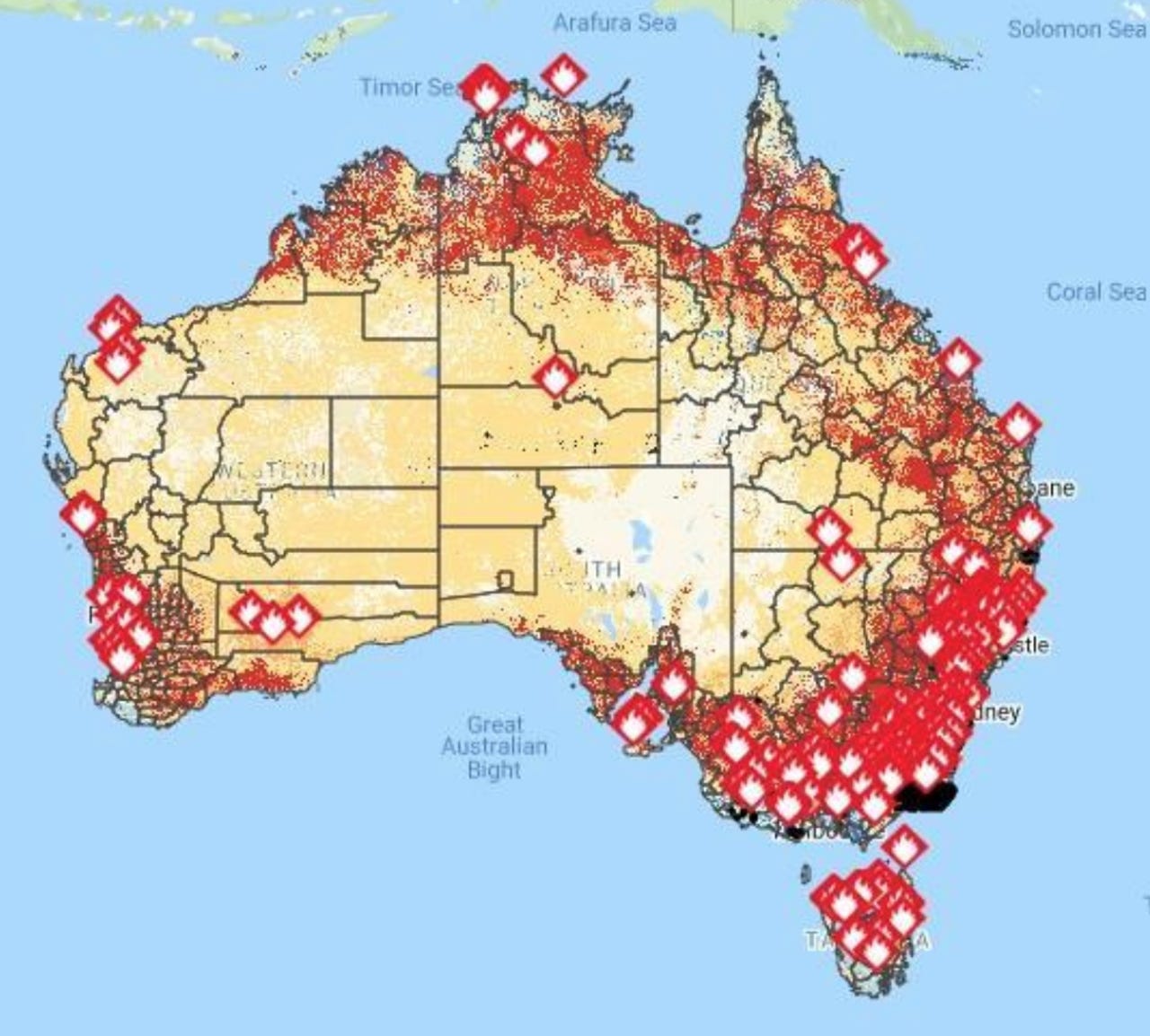
The interactive map that tracks vegetation moisture levels taken on 21 January 2020.
More than 10 million hectares of bushland have so far been burnt during this year's fire season in Australia. And based on studies by Australian National University (ANU) researchers, the fires are only expected to worsen over time.
"More frequent and severe bushfires are expected in the coming years," warned ANU senior lecturer in environment and engineering Marta Yebra.
"More people will be living in high-risk bushfire areas and there will be more competition for firefighting resources."
"A holistic perspective on using information technology [to fight fires] is to first prioritise the surveyance in high-risk areas, and the second is to detect small fires before they become uncontrollable and then extinguish them. These could contribute to bleach future fire management challenges."
With that in mind, Yebra and her team worked with the Bushfire and Natural Hazard Cooperative Research Centre (CRC) to develop a prototype that provides near real-time information about the moisture content of 'live fuel', such as trees, shrubs, grass, and other foliage, and how it could affect the spread of bushfires.
Yebra highlighted how tracking moisture content in live fuel could help land and emergency managers better understand potential fire danger areas and improve forecasting to facilitate back burning.
See also: How AI could save the environment (TechRepublic)
She said given the severity of this fire season, which was fuelled by a combination of low rainfall levels, high temperatures, and extremely dry vegetation and soil, access to such information is crucial for fire managers.
"The forests of New South Wales normally burn in Australia as soon as there is a source of ignition and atmospheric conditions that favour the spread of the fire. However, these fires are not usually very virulent because the vegetation or fuel -- especially the treetops -- are not dry enough to sustain a fire, and therefore the fires are controlled relatively quickly," Yebra told ZDNet.
"However, in 2019 Australia broke records of high temperatures and low rainfall, which produced water stress, even in the wettest and tropical forests of Australia."
"We saw this when the 2019 fire season started as early as September in Southern Queensland and the subtropical rainforests were burning. These forests are typically too wet to sustain a fire, but given that Australia broke records of heat and drought, even these humid forest types became flammable and developed into fires."
The Australian Flammability Monitoring System uses data collected through remote sensors from satellites. The information is displayed on an interactive map, so fire managers can use the data to determine the placement of firefighting efforts.
One of these sensors used for the system includes the NASA moderate resolution imaging spectroradiometer that helps determine the characteristics of fuel state and conditions, including moisture content.
Read more: Internet of Things (IoT): Cheat sheet (TechRepublic)
There's also the use of a light detection and ranging sensor, which measures variable distances of vegetation to the earth to understand different characteristics, such as canopy cover.
"Fuel moisture, cover, and structure are all critical fire danger and behaviour variables. Therefore, quantifying when and where vegetation is approaching critical levels associated with the occurrence of wildfires is vitally important for assessing fire danger and behaviour," Yebra said.
"Additionally, this information is used to find containment lines and help with firefighting strategies. For instance, it can help locate sites free of trees to winch specialist firefighters in or to try to pick the easiest line to construct walking tracks to the fire."
Data is also collected from the Japanese Himawari-8 satellite to help detect short-lived active fires, and track in detail the evolution of fire lines and fire radiative power.
In addition, the monitoring system draws on satellite data from the European Space Agency's Sentinel-2 to analyse fire severity and vegetation recovery.
"Analysing fire severity right after the fire is of ultimate importance for targeting remediation efforts to protect, for example, water supplies post fire, while vegetation recovery will dictate the amount of fuel available for the next fire season," Yebra said.
According to Bushfire and Natural Hazard CRC research director John Bates, the prototype system has the potential to extend the existing system that's used to map moisture conditions of dead fuel, such as twigs, fallen trees, or any other dead vegetation.
"We really don't have a system for measuring or understanding what was happening in the live fuel environment. It's a gap in our knowledge, and what this project was doing was attempting to address that gap so we can understand how much has changed," Bates told ZDNet.
"Once we have that data and system in place to look and learn what that system can tell us about the environment and whether something is more or less likely to be subject to burning if a fire came through."
Related coverage
Twitter bots and trolls promote conspiracy theories about Australian bushfires
Facebook Disaster Maps data plays a part in tackling Australia's bushfires
ANU applies space tech to predict future droughts and bushfires
Deloitte says 41% of Aussie execs want new tech to tackle climate change, social issues